
Correcting a Century-Old Cartographic Myth
For centuries, European explorers and cartographers speculated about the true geography of California. One of the most enduring misconceptions in early mapmaking was the Island of California, a belief that persisted for well over a century. However, by the 18th century, more accurate explorations had revealed that California was, in fact, a peninsula rather than an island.
This long-standing geographical error was a subject of great interest to scholars like Samuel Engel, an 18th-century librarian and geographer who dedicated much of his research to Arctic exploration and alternative routes to India. His work contributed significantly to the evolving understanding of North American geography.
Samuel Engel’s Contributions to Cartography
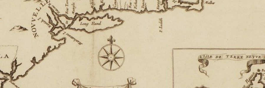
Engel’s geographical studies sought to clarify misconceptions about the American continent, particularly the idea of a navigable northern passage. The map detail shown here is from his work Mémoires et Observations Géographiques et Critiques… (1765), which was instrumental in shaping contemporary geographic thought. His research played a role in correcting errors perpetuated by earlier maps and speculative European accounts.
A Legacy of Exploration and Discovery
This document is part of a private collection that showcases significant historical works on exploration and cartography. Such maps remind us of the evolution of human knowledge and the gradual correction of myths through scientific inquiry and exploration.
For more insights into historical cartography and rare collectible books, visit www.FintaraGallery.com.